Cité n°11 de Béthune topographic map
Interactive map
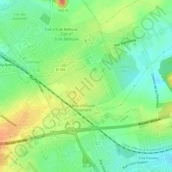
Click on the map to display elevation.
About this map
Name: Cité n°11 de Béthune topographic map, elevation, terrain.
Average elevation: 66 m
Minimum elevation: 45 m
Maximum elevation: 94 m

Click on the map to display elevation.
Name: Cité n°11 de Béthune topographic map, elevation, terrain.
Average elevation: 66 m
Minimum elevation: 45 m
Maximum elevation: 94 m