Geolocate

Vitosha topographic map

Click on the map to display elevation.

About this map

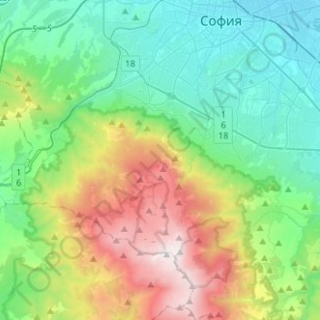
Name: Vitosha topographic map, elevation, terrain.

Location: Vitosha, Sofia City, Sofia-City, Bulgaria (42.56164 23.13931 42.67180 23.38827)

Average elevation: 1,036 m

Minimum elevation: 525 m

Maximum elevation: 2,282 m

Gear up for your next adventure:

👟Leg Gaiters - Keep debris, mud, and snow out of your boots
Bushcraft Tarp - Versatile emergency shelter or gear protection
🧥Thermal Fleece Jacket - Versatile insulation for changing mountain temperatures
🥾Trail Hiking Boots - Supportive boots for rough trails
🧥Ultralight Puffy Jacket - Maximum warmth that packs down to the size of an orange

As an Amazon Associate, this site earns from qualifying purchases at no extra cost to you.