
Thank you for supporting this site ❤️
Make a donation
Make a donation
Gear up for your next adventure:
As an Amazon Associate, this site earns from qualifying purchases at no extra cost to you.
Regoufe topographic map
Click on the map to display elevation.
Thank you for supporting this site ❤️
Make a donation
Make a donation
Gear up for your next adventure:
As an Amazon Associate, this site earns from qualifying purchases at no extra cost to you.
About this map
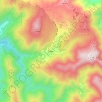
Name: Regoufe topographic map, elevation, terrain.
Location: Regoufe, Covelo de Paivó e Janarde, Arouca, Aveiro, Portugal (40.85671 -8.15396 40.89671 -8.11396)
Average elevation: 691 m
Minimum elevation: 324 m
Maximum elevation: 987 m
Thank you for supporting this site ❤️
Make a donation
Make a donation
Gear up for your next adventure:
As an Amazon Associate, this site earns from qualifying purchases at no extra cost to you.
Other topographic maps
Click on a map to view its topography, its elevation and its terrain.