
Thank you for supporting this site ❤️
Make a donation
Make a donation
Gear up for your next adventure:
As an Amazon Associate, this site earns from qualifying purchases at no extra cost to you.
Bhilarwadi topographic map
Click on the map to display elevation.
Thank you for supporting this site ❤️
Make a donation
Make a donation
Gear up for your next adventure:
As an Amazon Associate, this site earns from qualifying purchases at no extra cost to you.
About this map
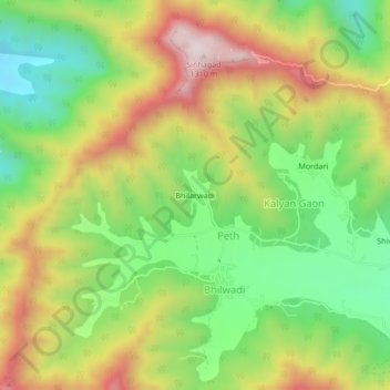
Name: Bhilarwadi topographic map, elevation, terrain.
Location: Bhilarwadi, Peth, Haveli, Pune, Maharashtra, India (18.33083 73.73405 18.37083 73.77405)
Average elevation: 976 m
Minimum elevation: 703 m
Maximum elevation: 1,317 m
Thank you for supporting this site ❤️
Make a donation
Make a donation
Gear up for your next adventure:
As an Amazon Associate, this site earns from qualifying purchases at no extra cost to you.