Geolocate

Mason topographic map

Click on the map to display elevation.

About this map

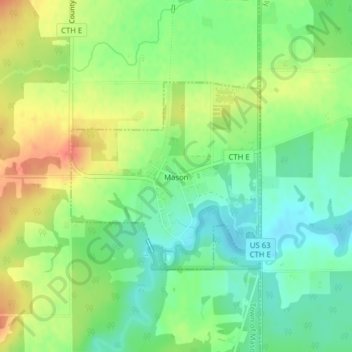
Name: Mason topographic map, elevation, terrain.

Location: Mason, Bayfield County, Wisconsin, United States (46.42805 -91.07179 46.44243 -91.05068)

Average elevation: 293 m

Minimum elevation: 270 m

Maximum elevation: 322 m

Other topographic maps

Click on a map to view its topography, its elevation and its terrain.

Grand View

United States > Wisconsin > Bayfield County

Average elevation: 314 m

Drummond

United States > Wisconsin > Bayfield County

Average elevation: 402 m

Barksdale

United States > Wisconsin > Bayfield County

Average elevation: 197 m

Cable

United States > Wisconsin > Bayfield County

Average elevation: 418 m

Port Wing

United States > Wisconsin > Bayfield County

Average elevation: 204 m

Devils Lake

United States > Wisconsin > Bayfield County

Average elevation: 361 m

Lund Lake

United States > Wisconsin > Bayfield County

Average elevation: 367 m

Cornucopia

United States > Wisconsin > Bayfield County

Average elevation: 212 m

Lake Nokomis

United States > Wisconsin > Bayfield County

Average elevation: 362 m

Herbster

United States > Wisconsin > Bayfield County

Average elevation: 196 m

Delta

United States > Wisconsin > Bayfield County

Average elevation: 335 m

Gear up for your next adventure:

🔋Emergency Crank Radio - Weather alerts and power without needing batteries
💧Hydration Pack - Hands-free hydration system for long hikes
🩹Compact First Aid Kit - Pre-packed essentials for common trail injuries
🪑Insulated Seat Pad - Protect your seat from cold rocks and wet logs
🚲Bike Repair Kit - Essential tools for on-trail mechanical issues

As an Amazon Associate, this site earns from qualifying purchases at no extra cost to you.