
Bryce Canyon National Park topographic map
Interactive map
Click on the map to display elevation.
About this map
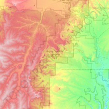
Name: Bryce Canyon National Park topographic map, elevation, terrain.
Average elevation: 2,259 m
Minimum elevation: 1,640 m
Maximum elevation: 2,902 m
Le parc se situe en altitude, son point culminant étant à 2 778 mètres et le plus bas, au niveau du ruisseau Yellow Creek, à 2 018 mètres d'altitude.