Geolocate

Camugao topographic map

Click on the map to display elevation.

About this map
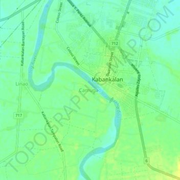
Name: Camugao topographic map, elevation, terrain.

Location: Camugao, Kabankalan, Negros Occidental, Negros Island Region, Philippines (9.96652 122.78959 10.00652 122.82959)

Average elevation: 11 m

Minimum elevation: 2 m

Maximum elevation: 20 m

Other topographic maps

Click on a map to view its topography, its elevation and its terrain.

Binicuil

Philippines > Negros Occidental > Kabankalan

Average elevation: 13 m

Camugao

Philippines > Negros Occidental > Kabankalan > Camugao

Average elevation: 12 m

Hilamonan

Philippines > Negros Occidental > Kabankalan

Average elevation: 102 m

Camingawan

Philippines > Negros Occidental > Kabankalan

Average elevation: 232 m

Gear up for your next adventure:

👟Trail Running Shoes - Agile footwear for fast-paced topographic exploration
🧳Compression Sacks - Maximize space in your backpack by shrinking gear
🧥Thermal Layer - Insulating layer for cold outdoor conditions
🧥Waterproof Jacket - Lightweight rain jackets for hiking and outdoor activities
🔪Outdoor Multitool - Versatile tool for repairs and food prep in the wild

As an Amazon Associate, this site earns from qualifying purchases at no extra cost to you.