Geolocate

Santa Rosa de Taguachi topographic map

Click on the map to display elevation.

About this map

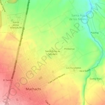
Name: Santa Rosa de Taguachi topographic map, elevation, terrain.

Location: Santa Rosa de Taguachi, Machachi, Pichincha, 171108, Ecuador (-0.51831 -78.57877 -0.47831 -78.53877)

Average elevation: 2,897 m

Minimum elevation: 2,798 m

Maximum elevation: 2,986 m

Gear up for your next adventure:

Lightweight Camping Tent - Portable shelter optimized for Canadian backcountry camping
🔋Lithium AA Batteries - Long-lasting power that performs in extreme cold
💡Solar Camping Lamp - Eco-friendly lighting for campsites
🧴Outdoor Sunscreen - High SPF protection for high-altitude UV exposure
🥽Outdoor Goggles - Protective eyewear for outdoor activities

As an Amazon Associate, this site earns from qualifying purchases at no extra cost to you.