Geolocate

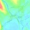
Fairfield topographic map

Click on the map to display elevation.

About this map
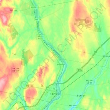
Name: Fairfield topographic map, elevation, terrain.

Location: Fairfield, Somerset County, Maine, United States (44.57732 -69.78027 44.70068 -69.57851)

Average elevation: 64 m

Minimum elevation: 12 m

Maximum elevation: 146 m

Other topographic maps

Click on a map to view its topography, its elevation and its terrain.

Pratt Hill

United States > Maine > Somerset County > Skowhegan

Average elevation: 113 m

Bigelow Hill

United States > Maine > Somerset County > Skowhegan

Average elevation: 158 m

Mackamp

United States > Maine > Somerset County

Average elevation: 395 m

Gray Island

United States > Maine > Somerset County > Solon

Average elevation: 105 m

Norris Brook

United States > Maine > Somerset County

Average elevation: 420 m

Gear up for your next adventure:

🥾Hiking Boots - Sturdy boots providing ankle support and traction on rugged trails
🌬️Windproof Camp Stove - Efficient cooking even on exposed mountain peaks
🧥Softshell Hiking Jacket - The perfect balance of wind protection and breathability
🔨Vehicle Emergency Tool - Safety tool for remote road trips to trailheads
💡Portable Camping Lamp - Rechargeable lamp for campsite lighting

As an Amazon Associate, this site earns from qualifying purchases at no extra cost to you.