Geolocate

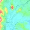
Prinza topographic map

Click on the map to display elevation.

About this map

Name: Prinza topographic map, elevation, terrain.

Location: Prinza, Teresa, Rizal, Calabarzon, 1960, Philippines (14.51933 121.19221 14.55933 121.23221)

Average elevation: 86 m

Minimum elevation: 12 m

Maximum elevation: 260 m

Other topographic maps

Click on a map to view its topography, its elevation and its terrain.
Teresa River

Philippines > Rizal > Teresa > Bagumbayan

Average elevation: 73 m

Gear up for your next adventure:

🧴First Aid Kit - Essential first aid supplies for outdoor emergencies
👟Trail Running Shoes - Agile footwear for fast-paced topographic exploration
🧤Thermal Hiking Gloves - Grip-enhanced gloves for cold-weather altitude trekking
👖Convertible Hiking Pants - Zip-off legs to adapt to changing weather conditions
🦟Insect Repellent - Keep mosquitoes and black flies away in wooded areas

As an Amazon Associate, this site earns from qualifying purchases at no extra cost to you.