Geolocate

Kanyoni topographic map

Click on the map to display elevation.

About this map

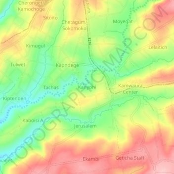
Name: Kanyoni topographic map, elevation, terrain.

Location: Kanyoni, Tinet ward, Kuresoi South, Nakuru, Rift Valley, Kenya (-0.43269 35.55061 -0.39269 35.59061)

Average elevation: 2,530 m

Minimum elevation: 2,451 m

Maximum elevation: 2,606 m

Gear up for your next adventure:

🥾Approach Boots - Comfortable boots for hiking and climbing approaches
🧦Thermal Socks - Warm socks for winter hiking or camping
🧤Thermal Hiking Gloves - Grip-enhanced gloves for cold-weather altitude trekking
🥾Hiking Shoes - Durable and comfortable shoes for trail hiking
🥾Durable Hiking Shoes - Long-lasting shoes for frequent hiking

As an Amazon Associate, this site earns from qualifying purchases at no extra cost to you.