Geolocate

Stradone topographic map

Click on the map to display elevation.

About this map

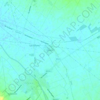
Name: Stradone topographic map, elevation, terrain.

Location: Stradone, Cannara, Perugia, Umbria, 06033, Italy (42.98791 12.57103 43.02791 12.61103)

Average elevation: 188 m

Minimum elevation: 184 m

Maximum elevation: 204 m

Gear up for your next adventure:

👟Sport Hiking Sandals - Breathable footwear for water crossings and camp rest
🥾Hiking Shorts - Breathable shorts suitable for summer hikes
🥾Waterproof Trail Shoes - Shoes designed to handle wet terrain
Tent Footprint - Protect tent floor and increase durability
🧤Thermal Hiking Gloves - Grip-enhanced gloves for cold-weather altitude trekking

As an Amazon Associate, this site earns from qualifying purchases at no extra cost to you.