
Montagny (FR) topographic map
Interactive map
Click on the map to display elevation.
About this map
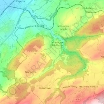
Name: Montagny (FR) topographic map, elevation, terrain.
Location: Montagny (FR), District de la Broye, Friburgo, 1774, Suiza (46.77631 6.95598 46.83294 7.02707)
Average elevation: 581 m
Minimum elevation: 445 m
Maximum elevation: 755 m