Geolocate

Brownsboro topographic map

Click on the map to display elevation.

About this map

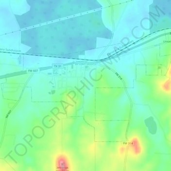
Name: Brownsboro topographic map, elevation, terrain.

Location: Brownsboro, Henderson County, Texas, 75756, United States (32.28272 -95.63885 32.31087 -95.58797)

Average elevation: 134 m

Minimum elevation: 108 m

Maximum elevation: 211 m

Other topographic maps

Click on a map to view its topography, its elevation and its terrain.

Trinity River

United States > Texas > Henderson County > Tool

Average elevation: 92 m

Murchison

United States > Texas > Henderson County

Average elevation: 146 m

Gear up for your next adventure:

💧Hydration Bladder - Hands-free hydration solution for long treks
🌬️Windproof Camp Stove - Efficient cooking even on exposed mountain peaks
🛶Canoe Life Vest - Safety vest for water sports
🥤Collapsible Travel Cup - Saves space and weight in your mess kit
💡Compact LED Flashlight - Powerful and portable flashlight for outdoor use

As an Amazon Associate, this site earns from qualifying purchases at no extra cost to you.