Geolocate

Remedios topographic map

Click on the map to display elevation.

About this map
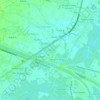
Name: Remedios topographic map, elevation, terrain.

Location: Remedios, Lubao, Pampanga, Central Luzon, 2005, Philippines (14.89881 120.55864 14.93881 120.59864)

Average elevation: 4 m

Minimum elevation: 0 m

Maximum elevation: 10 m

Other topographic maps

Click on a map to view its topography, its elevation and its terrain.

San Francisco

Philippines > Pampanga > Lubao

Average elevation: 15 m

Santa Barbara

Philippines > Pampanga > Lubao

Average elevation: 3 m

San Isidro

Philippines > Pampanga > Lubao

Average elevation: 10 m

Gear up for your next adventure:

👖Convertible Hiking Pants - Zip-off legs to adapt to changing weather conditions
🥽Outdoor Goggles - Protective eyewear for outdoor activities
⛺Tent Footprint - Protect tent floor and increase durability
🧥Softshell Jacket - Windproof and breathable jacket for hiking
🥫Freeze-Dried Meals - Lightweight, high-calorie nutrition for multi-day treks

As an Amazon Associate, this site earns from qualifying purchases at no extra cost to you.