
Thank you for supporting this site ❤️
Make a donation
Make a donation
Gear up for your next adventure:
As an Amazon Associate, this site earns from qualifying purchases at no extra cost to you.
Llallagua topographic map
Click on the map to display elevation.
Thank you for supporting this site ❤️
Make a donation
Make a donation
Gear up for your next adventure:
As an Amazon Associate, this site earns from qualifying purchases at no extra cost to you.
About this map
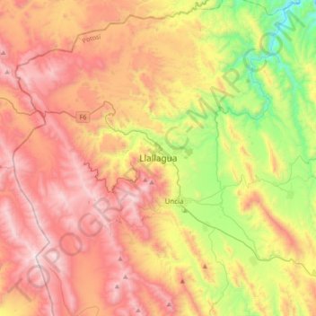
Name: Llallagua topographic map, elevation, terrain.
Location: Llallagua, Provincia Rafael Bustillo, Potosí, Bolivia (-18.58274 -66.74518 -18.26274 -66.42518)
Average elevation: 4,068 m
Minimum elevation: 3,313 m
Maximum elevation: 4,788 m
Thank you for supporting this site ❤️
Make a donation
Make a donation
Gear up for your next adventure:
As an Amazon Associate, this site earns from qualifying purchases at no extra cost to you.