
Islares topographic map
Click on the map to display elevation.
Islares
Islares es una localidad del municipio de Castro-Urdiales (Cantabria). En el año 2019 contaba con una población de 355 habitantes (INE). La localidad se encuentra a 30 metros de altitud sobre el nivel del mar, y a 8 kilómetros de la capital municipal, Castro-Urdiales.
About this map
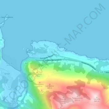
Name: Islares topographic map, elevation, terrain.
Location: Islares, Castro-Urdiales, Cantabria, 39798, España (43.38434 -3.31955 43.42434 -3.27955)
Average elevation: 111 m
Minimum elevation: -3 m
Maximum elevation: 617 m