Geolocate

Cochran topographic map

Click on the map to display elevation.

About this map

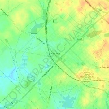
Name: Cochran topographic map, elevation, terrain.

Location: Cochran, Bleckley County, Georgia, 31014, United States (32.37129 -83.37419 32.40515 -83.32620)

Average elevation: 109 m

Minimum elevation: 92 m

Maximum elevation: 125 m

Gear up for your next adventure:

🧥Softshell Hiking Jacket - The perfect balance of wind protection and breathability
🛁Quick-Dry Microfiber Towel - Space-saving towel that dries rapidly on the move
🚲Bike Repair Kit - Essential tools for on-trail mechanical issues
🧊Insulated Water Bottle - Keeps drinks cold in summer and prevents freezing in winter
🧥Waterproof Hiking Jacket - Protect yourself from rain and wind while hiking

As an Amazon Associate, this site earns from qualifying purchases at no extra cost to you.