Geolocate

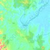
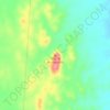
Cobramunga topographic map

Click on the map to display elevation.

About this map

Name: Cobramunga topographic map, elevation, terrain.

Location: Cobramunga, Murray River Council, New South Wales, 2732, Australia (-35.50668 143.82219 -35.36466 143.95783)

Average elevation: 73 m

Minimum elevation: 69 m

Maximum elevation: 80 m

Other topographic maps

Click on a map to view its topography, its elevation and its terrain.
Rose Seidler House

Australia > New South Wales > Sydney

Average elevation: 153 m

Mount Annan

Australia > New South Wales > Sydney

Average elevation: 115 m

Grafton

Australia > New South Wales

Average elevation: 36 m

Herron Park

Australia > New South Wales > Sydney

Average elevation: 28 m

Dark Gully Reserve

Australia > New South Wales > Sydney

Average elevation: 14 m

Poley Mountain

Australia > New South Wales

Average elevation: 465 m

Castle Mountain

Australia > New South Wales > Quirindi

Average elevation: 578 m

Comara

Australia > New South Wales

Average elevation: 909 m

Gear up for your next adventure:

🎒Hiking Daypack - Lightweight and durable backpacks for day trips and excursions
🥾Approach Shoes - Shoes designed for climbing approaches and rugged trails
🌬️Windproof Camp Stove - Efficient cooking even on exposed mountain peaks
🥾Trail Running Shoes - Lightweight and durable shoes for trail running
🥾Hiking Gaiters - Protect legs and shoes from mud, snow, and debris

As an Amazon Associate, this site earns from qualifying purchases at no extra cost to you.