
Thank you for supporting this site ❤️
Make a donation
Make a donation
Gear up for your next adventure:
As an Amazon Associate, this site earns from qualifying purchases at no extra cost to you.
Asisan topographic map
Click on the map to display elevation.
Thank you for supporting this site ❤️
Make a donation
Make a donation
Gear up for your next adventure:
As an Amazon Associate, this site earns from qualifying purchases at no extra cost to you.
About this map
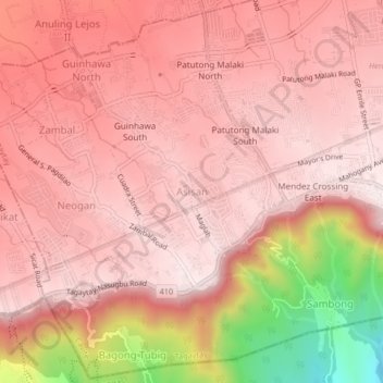
Name: Asisan topographic map, elevation, terrain.
Location: Asisan, Tagaytay, Cavite, Calabarzon, 4120, Philippines (14.07864 120.88876 14.11864 120.92876)
Average elevation: 526 m
Minimum elevation: 87 m
Maximum elevation: 667 m
Thank you for supporting this site ❤️
Make a donation
Make a donation
Gear up for your next adventure:
As an Amazon Associate, this site earns from qualifying purchases at no extra cost to you.