Geolocate

Asisan topographic map

Click on the map to display elevation.

About this map

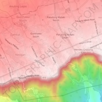
Name: Asisan topographic map, elevation, terrain.

Location: Asisan, Tagaytay, Cavite, Calabarzon, 4120, Philippines (14.07864 120.88876 14.11864 120.92876)

Average elevation: 526 m

Minimum elevation: 87 m

Maximum elevation: 667 m

Gear up for your next adventure:

💧Hydration Bladder - Hands-free hydration solution for long treks
🧊Insulated Water Bottle - Keeps drinks cold in summer and prevents freezing in winter
💧Hydration Pack - Hands-free hydration system for long hikes
🧥Softshell Hiking Jacket - The perfect balance of wind protection and breathability
🔋Lithium AA Batteries - Long-lasting power that performs in extreme cold

As an Amazon Associate, this site earns from qualifying purchases at no extra cost to you.