Geolocate

La Hoya topographic map

Click on the map to display elevation.

About this map

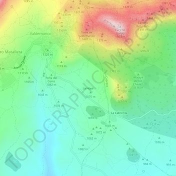
Name: La Hoya topographic map, elevation, terrain.

Location: La Hoya, Valdemanco, Comunidad de Madrid, 28751, España (40.84122 -3.66940 40.88122 -3.62940)

Average elevation: 1,115 m

Minimum elevation: 918 m

Maximum elevation: 1,545 m

Gear up for your next adventure:

🏕️Camping Hammock - Integrated protection for sleeping between trees
🥾Waterproof Hiking Boots - Essential footwear for rugged terrain and wet Canadian trails
👖Convertible Hiking Pants - Zip-off legs to adapt to changing weather conditions
🧊Insulated Water Bottle - Keeps drinks cold in summer and prevents freezing in winter
🧰Survival Kit - Essential gear for emergencies in the wilderness

As an Amazon Associate, this site earns from qualifying purchases at no extra cost to you.