
Thank you for supporting this site ❤️
Make a donation
Make a donation
Gear up for your next adventure:
As an Amazon Associate, this site earns from qualifying purchases at no extra cost to you.
Cos topographic map
Click on the map to display elevation.
Thank you for supporting this site ❤️
Make a donation
Make a donation
Gear up for your next adventure:
As an Amazon Associate, this site earns from qualifying purchases at no extra cost to you.
About this map
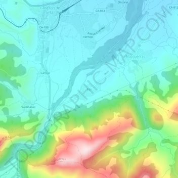
Name: Cos topographic map, elevation, terrain.
Location: Cos, Mazcuerras, Cantabria, Cantábria, 39592, Espanha (43.27027 -4.24375 43.31027 -4.20375)
Average elevation: 213 m
Minimum elevation: 109 m
Maximum elevation: 524 m
Thank you for supporting this site ❤️
Make a donation
Make a donation
Gear up for your next adventure:
As an Amazon Associate, this site earns from qualifying purchases at no extra cost to you.