
Kühtai topographic map
Interactive map
Click on the map to display elevation.
About this map
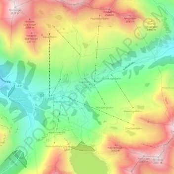
Name: Kühtai topographic map, elevation, terrain.
Location: Kühtai, Gemeinde Silz, Bezirk Imst, Tirol, 6183, Österreich (47.19362 11.00340 47.23362 11.04340)
Average elevation: 2,265 m
Minimum elevation: 1,826 m
Maximum elevation: 2,807 m
Der Ort befindet sich in einer Höhe von rund 2.020 m und ist einer der höchstgelegenen Skiorte Österreichs.