
Dhule topographic map
Interactive map
Click on the map to display elevation.
About this map
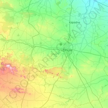
Name: Dhule topographic map, elevation, terrain.
Location: Dhule, Maharashtra, Inde (20.62736 74.43497 21.13130 74.99147)
Average elevation: 348 m
Minimum elevation: 173 m
Maximum elevation: 874 m
Other topographic maps
Click on a map to view its topography, its elevation and its terrain.
Lendi
Inde > Maharashtra > Dhule > Kusumbe
Lendi, Kusumbe, Dhule, Dhule District, Maharashtra, 424302, Inde
Average elevation: 352 m