Geolocate

Cumbicus topographic map

Click on the map to display elevation.

About this map

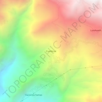
Name: Cumbicus topographic map, elevation, terrain.

Location: Cumbicus, Magdalena, Cajamarca, Perú (-7.23386 -78.65263 -7.19386 -78.61263)

Average elevation: 2,582 m

Minimum elevation: 1,692 m

Maximum elevation: 3,512 m

Gear up for your next adventure:

🔥Emergency Fire Starter - Reliable ignition source for all weather conditions
🧢Hiking Hat - Sun-protective and breathable hats for long treks
👟Trail Running Shoes - Agile footwear for fast-paced topographic exploration
🧦Hiking Socks - Moisture-wicking and comfortable socks for long hikes
🥾Durable Hiking Shoes - Long-lasting shoes for frequent hiking

As an Amazon Associate, this site earns from qualifying purchases at no extra cost to you.