Geolocate

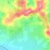
Saincaize-Meauce topographic map

Click on the map to display elevation.

About this map

Name: Saincaize-Meauce topographic map, elevation, terrain.

Location: Saincaize-Meauce, Nevers, Nièvre, Bourgogne-Franche-Comté, France métropolitaine, 58470, France (46.88112 3.04991 46.93648 3.12385)

Average elevation: 199 m

Minimum elevation: 164 m

Maximum elevation: 272 m

Other topographic maps

Click on a map to view its topography, its elevation and its terrain.
Gear up for your next adventure:

🥾Hiking Gaiters - Protect legs and shoes from mud, snow, and debris
🔪Outdoor Multitool - Versatile tool for repairs and food prep in the wild
🔭Outdoor Binoculars - Lightweight binoculars for birdwatching and hiking
🥾Waterproof Hiking Shoes - Durable shoes for wet and rugged trails
⛺Camping Tent - Weather-resistant tents suitable for 2 to 6 people

As an Amazon Associate, this site earns from qualifying purchases at no extra cost to you.