Geolocate

Streumen topographic map

Click on the map to display elevation.

About this map

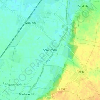
Name: Streumen topographic map, elevation, terrain.

Location: Streumen, Wülknitz, Röderaue-Wülknitz, Meißen, Saxony, Germany (51.33828 13.38540 51.37828 13.42540)

Average elevation: 102 m

Minimum elevation: 93 m

Maximum elevation: 119 m

Gear up for your next adventure:

🧴Outdoor Sunscreen - High SPF protection for high-altitude UV exposure
🧢Outdoor Cap - Protective cap for sun and rain during hikes
🥾Mountain Hiking Boots - High-traction boots for rocky terrain
📷Outdoor Action Camera - Capture high-elevation views and rugged adventures
🥫Freeze-Dried Meals - Lightweight, high-calorie nutrition for multi-day treks

As an Amazon Associate, this site earns from qualifying purchases at no extra cost to you.