
Make a donation
Gear up for your next adventure:
As an Amazon Associate, this site earns from qualifying purchases at no extra cost to you.
Rosenberg topographic map
Click on the map to display elevation.
Make a donation
Gear up for your next adventure:
As an Amazon Associate, this site earns from qualifying purchases at no extra cost to you.
Rosenberg
Rosenberg war ursprünglich ein großes Moorgebiet, aus dem einige markante Punkte als Anhöhen herausragten. Die vergebenen Bezeichnungen mit der Endung -berg wie Wullenberg, Schwarzeberg, Ahrensberg und Rosenberg sind stark übertrieben, da die Anhöhen nur wenige Meter höher lagen als das sie umgebene Moor. Der Rosenberg, der heute nicht mehr vorhanden ist, war Standort einer Schäferei. Sie wurde von einem Schäfer mit dem Namen Rose betrieben und gab dem Berg seinen Namen. Anfang des 19. Jahrhunderts entstanden die ersten Wohnstätten in Form von Plaggenhütten. Ab 1860 entstanden nur noch feste Häuser. 1872 erfolgte die Ansiedlung des Torfwerkes Ruschmann und Carls, dass ein wichtiger Arbeitgeber war.
Make a donation
Gear up for your next adventure:
As an Amazon Associate, this site earns from qualifying purchases at no extra cost to you.
About this map
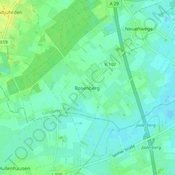
Name: Rosenberg topographic map, elevation, terrain.
Average elevation: 6 m
Minimum elevation: -1 m
Maximum elevation: 19 m
Make a donation
Gear up for your next adventure:
As an Amazon Associate, this site earns from qualifying purchases at no extra cost to you.
Other topographic maps
Click on a map to view its topography, its elevation and its terrain.