
Thank you for supporting this site ❤️
Make a donation
Make a donation
Gear up for your next adventure:
As an Amazon Associate, this site earns from qualifying purchases at no extra cost to you.
Oto topographic map
Click on the map to display elevation.
Thank you for supporting this site ❤️
Make a donation
Make a donation
Gear up for your next adventure:
As an Amazon Associate, this site earns from qualifying purchases at no extra cost to you.
About this map
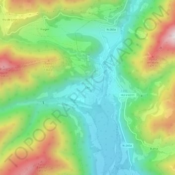
Name: Oto topographic map, elevation, terrain.
Location: Oto, Broto, Sobrarbe, Huesca, Aragon, 22370, Espagne (42.57866 -0.14837 42.61866 -0.10837)
Average elevation: 1,122 m
Minimum elevation: 852 m
Maximum elevation: 1,596 m
Thank you for supporting this site ❤️
Make a donation
Make a donation
Gear up for your next adventure:
As an Amazon Associate, this site earns from qualifying purchases at no extra cost to you.