
La Frontera topographic map
Interactive map
Click on the map to display elevation.
About this map
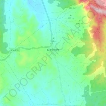
Name: La Frontera topographic map, elevation, terrain.
Location: La Frontera, Cuenca, Castilla-La Mancha, España (40.36479 -2.25892 40.43307 -2.17680)
Average elevation: 1,006 m
Minimum elevation: 870 m
Maximum elevation: 1,418 m