Geolocate

Mont Lambert topographic map

Click on the map to display elevation.

About this map
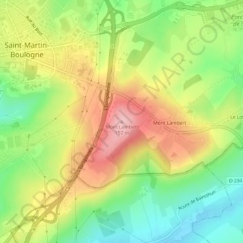
Name: Mont Lambert topographic map, elevation, terrain.

Location: Mont Lambert, Saint-Martin-Boulogne, Boulogne-sur-Mer, Pas-de-Calais, Hauts-de-France, France métropolitaine, 62280, France (50.71786 1.65049 50.71796 1.65059)

Average elevation: 101 m

Minimum elevation: 23 m

Maximum elevation: 188 m

Other topographic maps

Click on a map to view its topography, its elevation and its terrain.

Gear up for your next adventure:

🥾Hiking Gaiters - Protect legs and shoes from mud, snow, and debris
🥾Waterproof Hiking Boots - Boots keeping your feet dry in wet conditions
🌬️Windproof Camp Stove - Efficient cooking even on exposed mountain peaks
🧭GPS Handheld Device - Reliable GPS navigation for outdoor adventures
🔦UV Flashlight - Detect minerals or specific insects in the dark

As an Amazon Associate, this site earns from qualifying purchases at no extra cost to you.