Geolocate

Chandrapur topographic map

Click on the map to display elevation.

About this map

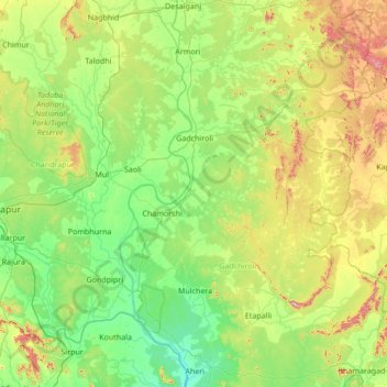
Name: Chandrapur topographic map, elevation, terrain.

Location: Chandrapur, Gadchiroli, Maharashtra, India (19.30000 79.30000 20.70000 80.70000)

Average elevation: 248 m

Minimum elevation: 112 m

Maximum elevation: 712 m

Gear up for your next adventure:

🧤Insulated Winter Gloves - Heavy-duty protection for sub-zero Canadian adventures
🥾Mountain Trail Shoes - High-traction shoes for mountain trails
🧥Thermal Layer - Insulating layer for cold outdoor conditions
🌡️Emergency Mylar Blankets - Compact thermal protection for unexpected nights outdoors
🕶️Polarized Sunglasses - Protect your eyes with durable polarized lenses

As an Amazon Associate, this site earns from qualifying purchases at no extra cost to you.