
Tinagacan topographic map
Interactive map
Click on the map to display elevation.
About this map
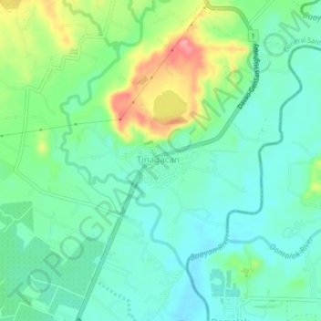
Name: Tinagacan topographic map, elevation, terrain.
Location: Tinagacan, South Cotabato, Soccsksargen, Philippines (6.19125 125.21787 6.23125 125.25787)
Average elevation: 58 m
Minimum elevation: 29 m
Maximum elevation: 127 m