
Lunglei topographic map
Interactive map
Click on the map to display elevation.
About this map
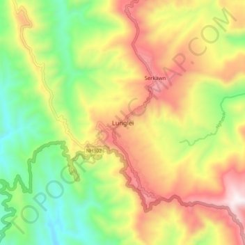
Name: Lunglei topographic map, elevation, terrain.
Location: Lunglei, Mizoram, 796701, India (22.85317 92.70704 22.93317 92.78704)
Average elevation: 756 m
Minimum elevation: 234 m
Maximum elevation: 1,374 m