Geolocate

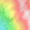
Le Mollard topographic map

Click on the map to display elevation.

About this map

Name: Le Mollard topographic map, elevation, terrain.

Location: Le Mollard, Beaune, Saint-Michel-de-Maurienne, Saint-Jean-de-Maurienne, Savoie, Auvergne-Rhône-Alpes, France métropolitaine, 73140, France (45.22969 6.44610 45.26969 6.48610)

Average elevation: 1,419 m

Minimum elevation: 676 m

Maximum elevation: 2,461 m

Other topographic maps

Click on a map to view its topography, its elevation and its terrain.
Gear up for your next adventure:

🧥Thermal Fleece Jacket - Versatile insulation for changing mountain temperatures
🧥Waterproof Jacket - Lightweight rain jackets for hiking and outdoor activities
⛺Bushcraft Tarp - Versatile emergency shelter or gear protection
🧢Sun Protection Cap - Breathable cap to protect from sun exposure
⛺Camping Essentials - All-in-one gear for a comfortable camping trip

As an Amazon Associate, this site earns from qualifying purchases at no extra cost to you.