Geolocate

Pachpadra topographic map

Click on the map to display elevation.

About this map

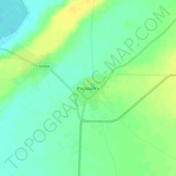
Name: Pachpadra topographic map, elevation, terrain.

Location: Pachpadra, Pachpadra Tehsil, Balotra, Rajasthan, 344032, India (25.88192 72.21325 25.96192 72.29325)

Average elevation: 113 m

Minimum elevation: 105 m

Maximum elevation: 123 m

Gear up for your next adventure:

🛏️Camping Sleeping Mat - Comfortable mats for sleeping outdoors
🧣Merino Neck Gaiter - Protects against wind, sun, and cold at high altitudes
🥾Lightweight Hiking Boots - Boots for comfort and mobility on long hikes
🧢Sun Hat - Wide-brim hat for sun protection
🧥Ultralight Puffy Jacket - Maximum warmth that packs down to the size of an orange

As an Amazon Associate, this site earns from qualifying purchases at no extra cost to you.