Geolocate

Bristol topographic map

Click on the map to display elevation.

About this map

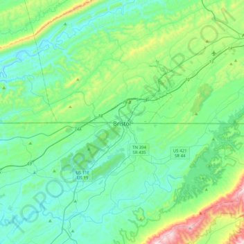
Name: Bristol topographic map, elevation, terrain.

Location: Bristol, Virginia, 37625, United States (36.43597 -82.34850 36.75597 -82.02850)

Average elevation: 579 m

Minimum elevation: 400 m

Maximum elevation: 1,310 m

Gear up for your next adventure:

🧢Outdoor Visor - Breathable visor for sunny hikes
🧤Insulated Winter Gloves - Heavy-duty protection for sub-zero Canadian adventures
🥾Waterproof Trail Shoes - Shoes designed to handle wet terrain
🌬️Windproof Camp Stove - Efficient cooking even on exposed mountain peaks
🛌Down Sleeping Bag - Superior warmth-to-weight ratio for cold nights

As an Amazon Associate, this site earns from qualifying purchases at no extra cost to you.