
Villarly topographic map
Click on the map to display elevation.
About this map
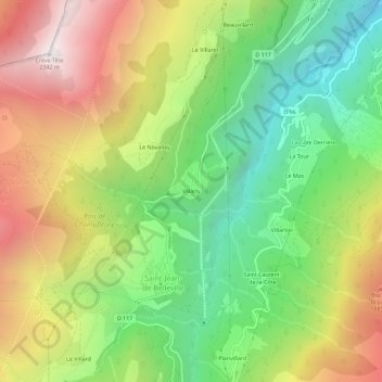
Name: Villarly topographic map, elevation, terrain.
Average elevation: 1,322 m
Minimum elevation: 553 m
Maximum elevation: 2,317 m
Other topographic maps
Click on a map to view its topography, its elevation and its terrain.
Saint-Jean-de-Belleville
France > Auvergne-Rhône-Alpes > Savoy > Les Belleville
Average elevation: 1,806 m
Saint-Jean-de-Belleville
France > Auvergne-Rhône-Alpes > Savoy > Les Belleville
Average elevation: 1,806 m