Geolocate

Milton topographic map

Click on the map to display elevation.

About this map

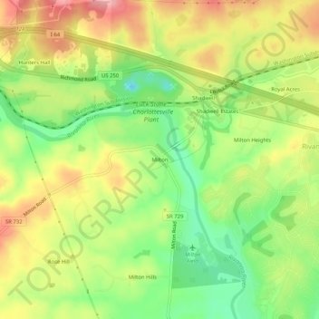
Name: Milton topographic map, elevation, terrain.

Location: Milton, Albemarle County, Virginia, 22909, United States (37.98514 -78.42251 38.02514 -78.38251)

Average elevation: 118 m

Minimum elevation: 53 m

Maximum elevation: 186 m

Gear up for your next adventure:

🩹Moleskin Blister Pads - Direct protection for painful foot pressure points
🔦UV Flashlight - Detect minerals or specific insects in the dark
🥾Hiking Gaiters - Protect legs and shoes from mud, snow, and debris
Camping Groundsheet - Protect your tent from moisture and dirt
🧣Merino Neck Gaiter - Protects against wind, sun, and cold at high altitudes

As an Amazon Associate, this site earns from qualifying purchases at no extra cost to you.