Geolocate

Triangle Island topographic map

Click on the map to display elevation.

About this map

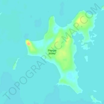
Name: Triangle Island topographic map, elevation, terrain.

Location: Triangle Island, Lake and Peninsula, Alaska, United States (59.70634 -154.48066 59.72832 -154.44320)

Average elevation: 14 m

Minimum elevation: 9 m

Maximum elevation: 40 m

Gear up for your next adventure:

🔪Outdoor Multitool - Versatile tool for repairs and food prep in the wild
🦌Outdoor Trail Camera - Monitor wildlife activity near your favorite spots
🧢Hiking Hat - Sun-protective and breathable hats for long treks
🥾Mountain Hiking Shoes - Shoes with superior grip for mountainous terrain
💡Solar Camping Lamp - Eco-friendly lighting for campsites

As an Amazon Associate, this site earns from qualifying purchases at no extra cost to you.