
El Marquéz topographic map
Interactive map
Click on the map to display elevation.
About this map
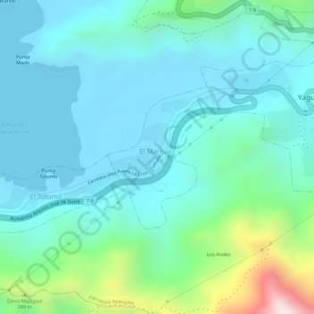
Name: El Marquéz topographic map, elevation, terrain.
Average elevation: 118 m
Minimum elevation: 0 m
Maximum elevation: 567 m
Other topographic maps
Click on a map to view its topography, its elevation and its terrain.
El Naranjo
Venezuela > Estado Sucre > Municipio Sucre
El Naranjo, Parroquia Raúl Leoni, Municipio Sucre, Estado Sucre, Venezuela
Average elevation: 215 m
Los Manantiales
Venezuela > Estado Sucre > Municipio Sucre
Los Manantiales, Parroquia Gran Mariscal, Municipio Sucre, Estado Sucre, Venezuela
Average elevation: 615 m