Geolocate

Greenwood topographic map

Click on the map to display elevation.

About this map

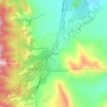
Name: Greenwood topographic map, elevation, terrain.

Location: Greenwood, Custer County, Colorado, 81253, United States (38.18573 -105.11654 38.22573 -105.07654)

Average elevation: 2,061 m

Minimum elevation: 1,874 m

Maximum elevation: 2,352 m

Other topographic maps

Click on a map to view its topography, its elevation and its terrain.

Westcliffe

United States > Colorado > Custer County

Average elevation: 2,404 m

Silver Cliff

United States > Colorado > Custer County

Average elevation: 2,455 m

Gear up for your next adventure:

🧥Waterproof Hiking Jacket - Protect yourself from rain and wind while hiking
🥾Hiking Shoes - Durable and comfortable shoes for trail hiking
🧊Insulated Water Bottle - Keeps drinks cold in summer and prevents freezing in winter
🔦UV Flashlight - Detect minerals or specific insects in the dark
🥾All-Terrain Hiking Boots - Versatile boots for varied hiking conditions

As an Amazon Associate, this site earns from qualifying purchases at no extra cost to you.