Geolocate

Cordobita topographic map

Click on the map to display elevation.

About this map

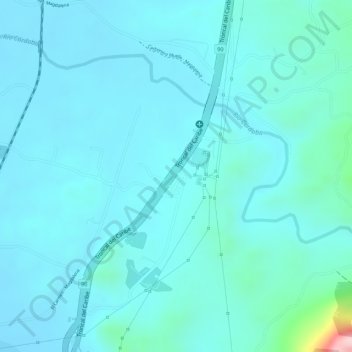
Name: Cordobita topographic map, elevation, terrain.

Location: Cordobita, Ciénaga, Magdalena, RAP Caribe, Colombia (11.01354 -74.21771 11.03354 -74.19771)

Average elevation: 42 m

Minimum elevation: 6 m

Maximum elevation: 291 m

Gear up for your next adventure:

🧢Outdoor Cap - Protective cap for sun and rain during hikes
🛏️Sleeping Bag - Warm and compact sleeping bags for outdoor camping
🕶️Polarized Sunglasses - Protect your eyes with durable polarized lenses
👟Sport Hiking Sandals - Breathable footwear for water crossings and camp rest
🎒Hiking Daypack - Lightweight and durable backpacks for day trips and excursions

As an Amazon Associate, this site earns from qualifying purchases at no extra cost to you.