
Yumuri topographic map
Interactive map
Click on the map to display elevation.
About this map
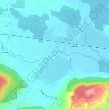
Name: Yumuri topographic map, elevation, terrain.
Location: Yumuri, Matanzas, 73000, Cuba (23.06376 -81.61708 23.06779 -81.59004)
Average elevation: 24 m
Minimum elevation: 2 m
Maximum elevation: 137 m
Other topographic maps
Click on a map to view its topography, its elevation and its terrain.
Río Yumurí
Río Yumurí, Matanzas Este, Ciudad de Matanzas, Matanzas, 73000, Cuba
Average elevation: 42 m