Geolocate

Mariah Buttu topographic map

Click on the map to display elevation.

About this map

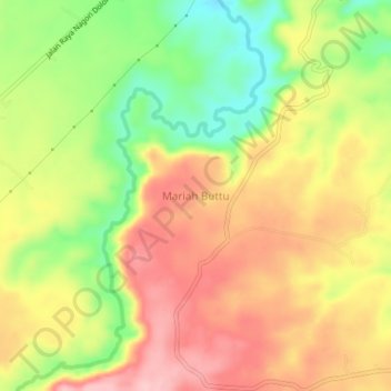
Name: Mariah Buttu topographic map, elevation, terrain.

Location: Mariah Buttu, Simalungun, North Sumatra, Sumatra, Indonesia (3.14768 98.84920 3.18768 98.88920)

Average elevation: 260 m

Minimum elevation: 167 m

Maximum elevation: 339 m

Gear up for your next adventure:

🛶Canoe Life Vest - Safety vest for water sports
🗺️Topographic Maps - Detailed maps to explore trails, mountains, and wilderness areas
🧴Sunscreen SPF - Broad-spectrum sunscreen for outdoor activities
🧦Hiking Liner Socks - Thin base layer to prevent friction and blisters
🔦LED Headlamp - Hands-free lighting for early morning starts or late finishes

As an Amazon Associate, this site earns from qualifying purchases at no extra cost to you.