
Thank you for supporting this site ❤️
Make a donation
Make a donation
Gear up for your next adventure:
As an Amazon Associate, this site earns from qualifying purchases at no extra cost to you.
乌克如县 topographic map
Click on the map to display elevation.
Thank you for supporting this site ❤️
Make a donation
Make a donation
Gear up for your next adventure:
As an Amazon Associate, this site earns from qualifying purchases at no extra cost to you.
About this map
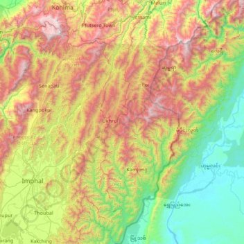
Name: 乌克如县 topographic map, elevation, terrain.
Location: 乌克如县, 曼尼普尔邦, 印度 (24.93007 94.11643 25.69210 94.74068)
Average elevation: 1,409 m
Minimum elevation: 128 m
Maximum elevation: 3,008 m
Thank you for supporting this site ❤️
Make a donation
Make a donation
Gear up for your next adventure:
As an Amazon Associate, this site earns from qualifying purchases at no extra cost to you.