Geolocate

Haveri topographic map

Click on the map to display elevation.

Haveri

Haveri is located at 14°48′N 75°24′E / 14.8°N 75.4°E / 14.8; 75.4. It has an average elevation of 572 metres (1876 feet).

Wikipedia (CC-BY-SA 3.0)

About this map

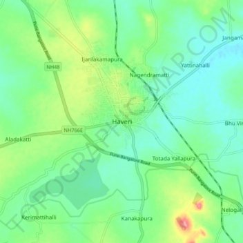
Name: Haveri topographic map, elevation, terrain.

Location: Haveri, Haveri taluku, Haveri District, Karnataka, 581110, India (14.74748 75.35967 14.82748 75.43967)

Average elevation: 564 m

Minimum elevation: 537 m

Maximum elevation: 629 m

Gear up for your next adventure:

🏃Hydration Running Vest - Carry water and maps close to your body for speed
🧥Waterproof Pants - Keep dry during rainy hiking conditions
🚲Heavy Duty Bike Lock - Secure your bike at the trailhead or during stops
🔦UV Flashlight - Detect minerals or specific insects in the dark
❄️Traction Ice Cleats - Slip-on spikes for icy trails and winter hiking

As an Amazon Associate, this site earns from qualifying purchases at no extra cost to you.