Geolocate

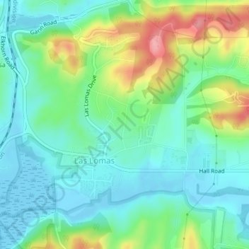
Las Lomas topographic map

Click on the map to display elevation.

Las Lomas

Las Lomas (Spanish for 'The Hills') is an unincorporated community and census-designated place (CDP) in Monterey County, California, United States. Las Lomas is located 7 miles (11 km) north-northwest of Prunedale. The elevation is 43 feet (13 m). The population was 3,046 at the 2020 census.

Wikipedia (CC-BY-SA 3.0)

About this map

Name: Las Lomas topographic map, elevation, terrain.

Location: Las Lomas, Hutchings Gate, Las Lomas, Monterey County, California, United States (36.85897 -121.74033 36.87931 -121.72233)

Average elevation: 35 m

Minimum elevation: -6 m

Maximum elevation: 118 m

Gear up for your next adventure:

🥾Waterproof Hiking Shoes - Durable shoes for wet and rugged trails
💧Hydration Bladder - Hands-free hydration solution for long treks
🌬️Windproof Camp Stove - Efficient cooking even on exposed mountain peaks
🥾Trail Running Shoes - Lightweight and durable shoes for trail running
🧴Sunscreen SPF - Broad-spectrum sunscreen for outdoor activities

As an Amazon Associate, this site earns from qualifying purchases at no extra cost to you.