
Thank you for supporting this site ❤️
Make a donation
Make a donation
Gear up for your next adventure:
As an Amazon Associate, this site earns from qualifying purchases at no extra cost to you.
Sandwich topographic map
Click on the map to display elevation.
Thank you for supporting this site ❤️
Make a donation
Make a donation
Gear up for your next adventure:
As an Amazon Associate, this site earns from qualifying purchases at no extra cost to you.
About this map
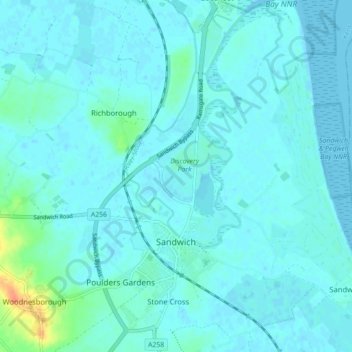
Name: Sandwich topographic map, elevation, terrain.
Location: Sandwich, Stone Cross, Dover, Kent, England, United Kingdom (51.25793 1.32070 51.31302 1.36964)
Average elevation: 5 m
Minimum elevation: -1 m
Maximum elevation: 40 m
Thank you for supporting this site ❤️
Make a donation
Make a donation
Gear up for your next adventure:
As an Amazon Associate, this site earns from qualifying purchases at no extra cost to you.